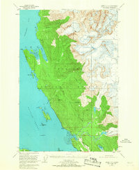
1951 Map of Juneau C-3
USGS Topo · Published 1967About this map
The Tongass National Forest dominates this coastal Alaska landscape, where the high peaks and glaciers of the coastal range meet the waters of the Favorite Channel. In the early 1950s, the region retained its wilderness character, punctuated by industrial history and maritime navigation markers. Mining activity is evident along the mountain slopes, notably at the Bessie Mine and Eagle River Mine, while the coastal waters are marked by a Lighthouse near Sentinel I and a Girl Scout Camp further south. The Glacier Highway provides the primary overland artery, connecting scattered clusters of Cabins and coastal landmarks. The presence of the Montana Creek Trail and various creek systems, such as Cowee Creek and the Herbert River, suggests a landscape used for both extraction and recreation during this postwar period of Alaskan development.
Find a feature on this map
39 named features on this map. Tap any name to fly to it.
Don’t see what you’re looking for? This feature index may not catch every label — zoom into the map to look around manually.
Map Details
Editions of this 1951 Juneau C-3 Map
3 editions found

Other maps of this area

1947 · Juneau B-3
USGS Topo · 1:63,360

1947 · Juneau B-2
USGS Topo · 1:63,360

1948 · Juneau B-4
USGS Topo · 1:63,360

1948 · Juneau C-4
USGS Topo · 1:63,360

1948 · Juneau D-3
USGS Topo · 1:63,360

1949 · Juneau B-3
USGS Topo · 1:62,500

1949 · Juneau B-2
USGS Topo · 1:62,500

1949 · Juneau D-4
USGS Topo · 1:63,360

1949 · Juneau C-4
USGS Topo · 1:63,360

1949 · Juneau D-3
USGS Topo · 1:63,360