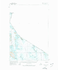
1960 Map of Juneau D-1
USGS Topo · Published 1977About this map
Glacial ice and high-altitude peaks dominate this section of the Boundary Ranges along the international border between Alaska and British Columbia. Surveyed in the mid-20th century, the landscape is defined by the massive convergence of the Matthes Glacier and Vaughan Lewis Glacier, which flow alongside the expansive Gilkey Glacier. The terrain is punctuated by significant summits including Mount Nesselrode and Mount Ogilvie, marking the jagged divide between the Haines Borough and the City and Borough of Juneau. To the south, the Spirit Range and Stronghold Peak tower over the depths of Avalanche Canyon, illustrating the sheer verticality of the region's topography. Notable landmarks such as The Citadel and Picket Gate Crags stand as prominent navigation points amidst the ice fields of the Demorest Glacier.
Find a feature on this map
27 named features on this map. Tap any name to fly to it.
Don’t see what you’re looking for? This feature index may not catch every label — zoom into the map to look around manually.
Map Details
Editions of this 1960 Juneau D-1 Map
2 editions found
Other maps of this area

1949 · Atlin
USGS Topo · 1:250,000

1951 · Juneau
USGS Topo · 1:250,000

1951 · Atlin
USGS Topo · 1:250,000

1953 · Taku River
USGS Topo · 1:250,000

1960 · Taku River C-6
USGS Topo · 1:63,360

1960 · Juneau D-1
USGS Topo · 1:63,360

1960 · Juneau C-2
USGS Topo · 1:63,360

1960 · Juneau D-2
USGS Topo · 1:63,360

1960 · Juneau C-1
USGS Topo · 1:63,360
1960 · Atlin A-7
USGS Topo · 1:63,360