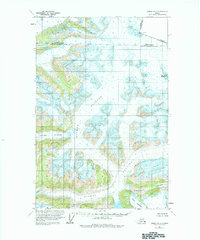
1960 Map of Juneau D-2
USGS Topo · Published 1984About this map
The international border between Alaska and British Columbia runs through this high-altitude landscape, defining the northeast edge of the Haines Borough and City and Borough of Juneau line. This 1960 survey, based on 1948 aerial photography, records a massive network of active ice fields and high-relief terrain where the Antler Glacier and Bucher Glacier dominate the central drainage. The map provides precise locations for named summits like Mount Bressler and markers along the Canada-United States boundary such as Boundary Peak 99. To the south, the dramatic convergence of the Gilkey Glacier and Echo Glacier carves through the land near the steep formation of The Wall and the depths of Avalanche Canyon.
Find a feature on this map
13 named features on this map. Tap any name to fly to it.
Don’t see what you’re looking for? This feature index may not catch every label — zoom into the map to look around manually.
Map Details
Editions of this 1960 Juneau D-2 Map
3 editions found

Other maps of this area

1948 · Juneau D-3
USGS Topo · 1:63,360

1949 · Atlin
USGS Topo · 1:250,000

1949 · Juneau D-3
USGS Topo · 1:63,360

1951 · Juneau
USGS Topo · 1:250,000

1951 · Atlin
USGS Topo · 1:250,000

1951 · Juneau C-3
USGS Topo · 1:63,360

1952 · Juneau C-3
USGS Topo · 1:63,360

1953 · Juneau D-3
USGS Topo · 1:63,360

1960 · Juneau D-1
USGS Topo · 1:63,360

1960 · Juneau C-2
USGS Topo · 1:63,360