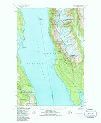
1949 Map of Juneau D-4
USGS Topo · Published 1985About this map
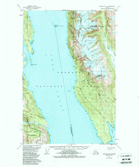
Tongass National Forest dominates this coastal landscape, where the steep peaks of the Kakuhan Range descend sharply into the deep waters of the Lynn Canal. This 1949 survey documents a region defined by its maritime and mining activity, featuring the Eldred Rock lighthouse and a concentration of hard-rock operations along the eastern shore. The geography is punctuated by the massive Endicott River delta and the protected waters of Rescue Harbor behind Sullivan Island.
Find a feature on this map
36 named features on this map. Tap any name to fly to it.
Don’t see what you’re looking for? This feature index may not catch every label — zoom into the map to look around manually.
Map Details
Editions of this 1949 Juneau D-4 Map
3 editions found
Other maps of this area

1948 · Juneau C-5
USGS Topo · 1:63,360

1948 · Juneau C-4
USGS Topo · 1:63,360

1948 · Juneau D-3
USGS Topo · 1:63,360

1948 · Skagway A-1
USGS Topo · 1:63,360

1949 · Atlin
USGS Topo · 1:250,000

1949 · Juneau D-5
USGS Topo · 1:63,360

1949 · Juneau D-4
USGS Topo · 1:63,360

1949 · Juneau C-4
USGS Topo · 1:63,360

1949 · Juneau D-3
USGS Topo · 1:63,360

1951 · Juneau
USGS Topo · 1:250,000