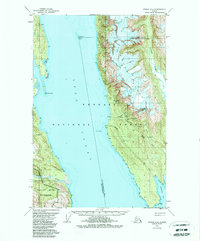
1949 Map of Juneau D-4
USGS Topo · Published 1988About this map
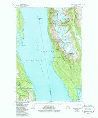
Mining operations and remote coastal outposts define the rugged eastern shore of Lynn Canal in this late 1940s landscape. Industrial activity is concentrated along the steep slopes of the Kakuhan Range, where the Kensington Mine, Horrible Mine, and Comet Mines reveal the area’s mineral prospects. An Aerial Tram and small settlements like Comet and Sher suggest the infrastructure once required to extract gold and other ores from this challenging terrain. Across the deep waters of the canal, Sullivan Island and its protected Rescue Harbor provide a maritime counterpoint to the mountain peaks. The map also records the Eldred Rock Lighthouse Helipad, a critical navigational aid at the confluence of the Endicott River and the main waterway. The southern reaches are dominated by Berners Bay, with the Jualin Mine located near Snowslide Gulch.
Find a feature on this map
32 named features on this map. Tap any name to fly to it.
Don’t see what you’re looking for? This feature index may not catch every label — zoom into the map to look around manually.
Map Details
Editions of this 1949 Juneau D-4 Map
3 editions found
Other maps of this area

1948 · Juneau C-5
USGS Topo · 1:63,360

1948 · Juneau C-4
USGS Topo · 1:63,360

1948 · Juneau D-3
USGS Topo · 1:63,360

1948 · Skagway A-1
USGS Topo · 1:63,360

1949 · Atlin
USGS Topo · 1:250,000

1949 · Juneau D-5
USGS Topo · 1:63,360

1949 · Juneau D-4
USGS Topo · 1:63,360

1949 · Juneau C-4
USGS Topo · 1:63,360

1949 · Juneau D-3
USGS Topo · 1:63,360

1951 · Juneau
USGS Topo · 1:250,000