
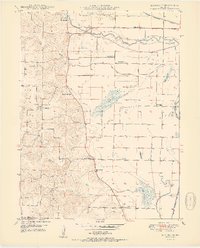
1950 Map of Kahoka SE
USGS Topo · Published 1950About this map
The Fox River meanders across this northeast Missouri landscape, flanked by a system of levees that define the agricultural character of the region. Just north of the Clay township line, the Chicago Burlington and Quincy railroad cuts through the flat river bottomlands, serving the scattered rural settlements and farmsteads. The map illustrates a densely settled rural community centered around several local institutions, including Winchester and numerous country schools such as Lone Star Sch and Plainview Sch.
Find a feature on this map
28 named features on this map. Tap any name to fly to it.
Don’t see what you’re looking for? This feature index may not catch every label — zoom into the map to look around manually.
Map Details
Editions of this 1950 Kahoka SE Map
2 editions found
Other maps of this area

1903 · Kahoka
USGS Topo · 1:125,000

1936 · Keokuk
USGS Topo · 1:62,500

1946 · Mendon
USGS Topo · 1:62,500

1948 · Mendon
USGS Topo · 1:62,500

1949 · Wayland
USGS Topo · 1:24,000

1949 · Kahoka SE
USGS Topo · 1:24,000

1949 · Kahoka
USGS Topo · 1:24,000

1949 · St. Patrick
USGS Topo · 1:24,000

1950 · Kahoka
USGS Topo · 1:24,000

1950 · Saint Patrick
USGS Topo · 1:24,000