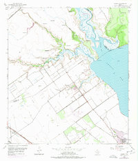
1952 Map of Kamey
USGS Topo · Published 1976About this map
The coastal marshes and prairie of Calhoun County meet the waters of Lavaca Bay in this mid-century survey. The landscape is defined by a dense network of hydrologic features, including numerous flowing wells and the meandering paths of Aguila Creek and Kentucky Mott Creek. Near the shoreline, Garcitas Cove is flanked by Bennett Point and Keeran Point, marking the transition from the upland cattle and oil country to the productive bay waters.
Find a feature on this map
26 named features on this map. Tap any name to fly to it.
Don’t see what you’re looking for? This feature index may not catch every label — zoom into the map to look around manually.
Map Details
Editions of this 1952 Kamey Map
Other maps of this area

1952 · Port Lavaca East
USGS Topo · 1:24,000

1952 · Point Comfort
USGS Topo · 1:24,000

1952 · Kamey
USGS Topo · 1:24,000

1952 · Port Lavaca West
USGS Topo · 1:24,000

1952 · La Salle
USGS Topo · 1:24,000

1952 · Marcado Creek
USGS Topo · 1:24,000

1952 · Placedo
USGS Topo · 1:24,000

1952 · Lolita
USGS Topo · 1:24,000

1952 · Green Lake
USGS Topo · 1:24,000

1953 · Beeville
USGS Topo · 1:250,000