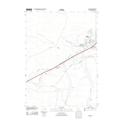
2012 Map of Kanda
USGS Topo · Published 2012About this map
White Mountain and the high desert terrain west of Rock Springs define this segment of the Wyoming landscape as recorded in 2012. The transit corridor is heavily marked by both modern infrastructure and historical pathways, including the Old Lincoln Hwy which runs parallel to the primary highway and railroad routes through Kanda. The settlement pattern shows the residential expansion of Clearview Acres and Purple Sage, concentrated along the northern and eastern edges of the sheet near the city limits. This survey illustrates the vital drainage systems of Bitter Cr and Little Bitter Cr as they navigate the arid floor between landmarks like Rock Canyon. The presence of Blairtown Flaming Gorge Rd underscores the area's importance as a gateway to regional recreation and transit south toward the gorge.
Find a feature on this map
33 named features on this map. Tap any name to fly to it.
Don’t see what you’re looking for? This feature index may not catch every label — zoom into the map to look around manually.
Map Details
Editions of this 2012 Kanda Map
This is the sole edition of this map. No revisions or reprints were ever made.
Other maps of this area

1908 · Rock Springs
USGS Topo · 1:62,500

1910 · Rock Springs
USGS Topo · 1:62,500

1954 · Rock Springs
USGS Topo · 1:250,000

1957 · Firehole Basin
USGS Topo · 1:62,500

1958 · Rock Springs
USGS Topo · 1:250,000

1961 · Scott Spring
USGS Topo · 1:24,000

1961 · Pilot Butte
USGS Topo · 1:24,000

1961 · Kanda
USGS Topo · 1:24,000

1961 · Green River
USGS Topo · 1:24,000

1962 · Rock Springs
USGS Topo · 1:250,000