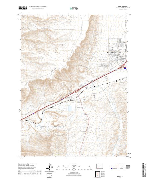
2021 Map of Kanda
USGS Topo · Published 2021About this map
Rock Springs and its western residential expansions define the eastern edge of this High Desert landscape, where suburban developments like Clearview Acres meet the dramatic rising front of White Mtn. The terrain is deeply incised by drainages such as Greens Canyon and Reiser Canyon, which cut through the uplifted benchlands. Historically, this area serves as a vital transportation corridor, illustrated by the presence of the Old Lincoln Hwy and the Union Pacific rail line threading through the valley of Bitter Cr. Smaller outlying settlements like Purple Sage and Kanda are situated near the highway and rail routes, reflecting the region's reliance on these major thoroughfares. The southern portion of the map reveals a shift toward civic and industrial infrastructure, including the Sweetwater County Justice Center and several canyon access points such as Rock Canyon.
Find a feature on this map
44 named features on this map. Tap any name to fly to it.
Don’t see what you’re looking for? This feature index may not catch every label — zoom into the map to look around manually.
Map Details
Editions of this 2021 Kanda Map
This is the sole edition of this map. No revisions or reprints were ever made.
Other maps of this area

1908 · Rock Springs
USGS Topo · 1:62,500

1910 · Rock Springs
USGS Topo · 1:62,500

1954 · Rock Springs
USGS Topo · 1:250,000

1957 · Firehole Basin
USGS Topo · 1:62,500

1958 · Rock Springs
USGS Topo · 1:250,000

1961 · Scott Spring
USGS Topo · 1:24,000

1961 · Pilot Butte
USGS Topo · 1:24,000

1961 · Kanda
USGS Topo · 1:24,000

1961 · Green River
USGS Topo · 1:24,000

1962 · Rock Springs
USGS Topo · 1:250,000