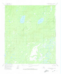
1953 Map of Kantishna River B-2
USGS Topo · Published 1974About this map
The Kantishna River dominates the southeastern quadrant of this Interior Alaska landscape, winding through a complex network of wetlands and oxbow lakes. This 1953 field-annotated survey reveals a wilderness defined by its waterways, where the meandering river contrasts with the more stable upland terrain to the north and west. At the center of the sheet, the prominent basins of West Twin Lake and East Twin Lake serve as major landmarks amidst the lower-elevation drainage systems. A lone Cabin situated near the river's bend provides a rare sign of human presence in this remote territory. The drainage pattern is further defined by seasonal or smaller flows including Lynx Creek and Dry Creek, illustrating the transition from the high-ground interior to the broad alluvial plains of the Kantishna basin.
Find a feature on this map
6 named features on this map. Tap any name to fly to it.
Don’t see what you’re looking for? This feature index may not catch every label — zoom into the map to look around manually.
Map Details
Editions of this 1953 Kantishna River B-2 Map
3 editions found
Other maps of this area

1948 · Kantishna River
USGS Topo · 1:250,000

1951 · Kantishna River
USGS Topo · 1:250,000

1952 · Kantishna River A-3
USGS Topo · 1:63,360

1952 · Kantishna River C-1
USGS Topo · 1:63,360

1952 · Kantishna River A-1
USGS Topo · 1:63,360

1952 · Kantishna River
USGS Topo · 1:250,000

1952 · Kantishna River A-2
USGS Topo · 1:63,360

1952 · Kantishna River B-1
USGS Topo · 1:63,360

1952 · Kantishna River C-3
USGS Topo · 1:63,360

1953 · Kantishna River B-2
USGS Topo · 1:63,360