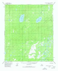
1953 Map of Kantishna River B-2
USGS Topo · Published 1977About this map
Kantishna River winds through this subarctic interior landscape, creating a complex network of oxbows and sloughs that define the southern half of the quadrangle. This 1952 aerial survey, field annotated in 1953, illustrates a wilderness largely devoid of established roads or towns, highlighting instead the natural hydrography of the Yukon-Koyukuk region. Notable water bodies such as West Twin Lake and East Twin Lake dominate the northern terrain, while smaller drainages like Lynx Creek and Dry Creek feed into the broader river system. A single Cabin located near the riverbank in the southeast corner provides a rare trace of human activity, suggesting a seasonal trapping or hunting site in an otherwise unsurveyed territory. The map serves as a primary record of the region's topography before significant modern shifts, capturing the precise character of its marshes and low-relief wetlands.
Find a feature on this map
6 named features on this map. Tap any name to fly to it.
Don’t see what you’re looking for? This feature index may not catch every label — zoom into the map to look around manually.
Map Details
Editions of this 1953 Kantishna River B-2 Map
3 editions found
Other maps of this area

1948 · Kantishna River
USGS Topo · 1:250,000

1951 · Kantishna River
USGS Topo · 1:250,000

1952 · Kantishna River A-3
USGS Topo · 1:63,360

1952 · Kantishna River C-1
USGS Topo · 1:63,360

1952 · Kantishna River A-1
USGS Topo · 1:63,360

1952 · Kantishna River
USGS Topo · 1:250,000

1952 · Kantishna River A-2
USGS Topo · 1:63,360

1952 · Kantishna River B-1
USGS Topo · 1:63,360

1952 · Kantishna River C-3
USGS Topo · 1:63,360

1953 · Kantishna River B-2
USGS Topo · 1:63,360