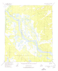
1953 Map of Kantishna River D-1
USGS Topo · Published 1974About this map
The Tanana River dominates this interior Alaska landscape, carving a wide path through complex wetlands and river islands. Near the northwestern bend, the settlement of Baker and the prominent Giroux Bluff overlook the confluence with Baker Creek. This 1950s survey documents a wilderness environment where transportation relied heavily on seasonal routes like the Sled Road that parallels the river, essential for movement before modern infrastructure reached these reaches of the Yukon-Koyukuk region.
Find a feature on this map
13 named features on this map. Tap any name to fly to it.
Don’t see what you’re looking for? This feature index may not catch every label — zoom into the map to look around manually.
Map Details
Editions of this 1953 Kantishna River D-1 Map
3 editions found
Other maps of this area

1945 · Livengood
USGS Topo · 1:250,000

1948 · Kantishna River
USGS Topo · 1:250,000

1950 · Fairbanks
USGS Topo · 1:250,000

1951 · Kantishna River
USGS Topo · 1:250,000

1951 · Fairbanks
USGS Topo · 1:250,000

1951 · Tanana
USGS Topo · 1:250,000

1951 · Livengood
USGS Topo · 1:250,000

1952 · Tanana A-1
USGS Topo · 1:63,360

1952 · Livengood A-6
USGS Topo · 1:63,360

1952 · Kantishna River C-1
USGS Topo · 1:63,360