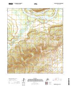
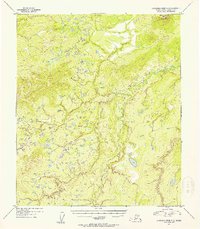
2017 Map of Kantishna River D-3 SW
USGS Topo · Published 2017About this map
Tanana River waters dominate the northern edge of this Interior Alaska landscape, where the braided river system creates complex navigation challenges through Patterson Chutes and around the significant landmass of Vachon Island. To the south, the meandering Cosna River winds through low-lying terrain before joining the larger river system via the Cosna Slough. This 2017 survey by the U.S. Geological Survey captures the hydrologic patterns and elevation contours of the Yukon-Koyukuk Census Area in a period defined by natural shifts in the river channels. The map is primarily an environmental record of the wilderness, showing the intersection of Township and Range boundaries across a region where moving water is the primary architect of the geography.
Find a feature on this map
13 named features on this map. Tap any name to fly to it.
Don’t see what you’re looking for? This feature index may not catch every label — zoom into the map to look around manually.
Map Details
Editions of this 2017 Kantishna River D-3 SW Map
This is the sole edition of this map. No revisions or reprints were ever made.
Other maps of this area

1948 · Kantishna River
USGS Topo · 1:250,000

1951 · Kantishna River
USGS Topo · 1:250,000

1952 · Kantishna River
USGS Topo · 1:250,000

1952 · Kantishna River D-3
USGS Topo · 1:63,360

1952 · Kantishna River C-3
USGS Topo · 1:63,360

1952 · Kantishna River C-4
USGS Topo · 1:63,360
1953 · Kantishna River D-4
USGS Topo · 1:63,360
1954 · Kantishna River D-3
USGS Topo · 1:63,360
1954 · Kantishna River D-4
USGS Topo · 1:63,360
1954 · Kantishna River C-3
USGS Topo · 1:63,360