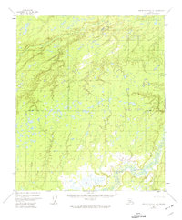
1952 Map of Kantishna River D-5
USGS Topo · Published 1974About this map
Chitanana River dominates the southeastern quadrant of this interior Alaska landscape, meandering through a complex network of wetlands and small water bodies. Compiled from 1952 aerial photography, the map reveals a remote territory defined by its hydrologic patterns rather than human infrastructure. The lack of roads or established settlements emphasizes the wilderness character of the region during the mid-twentieth century. Surveyed by the U.S. Geological Survey and the Bureau of Land Management, the sheet features a prominent Base Line which serves as a critical reference point for the township and range grid system in this unsurveyed territory. Small drainages, often simply labeled Creek, stitch together an intricate mosaic of thaw lakes and marshes characteristic of the northern floodplain.
Find a feature on this map
3 named features on this map. Tap any name to fly to it.
Don’t see what you’re looking for? This feature index may not catch every label — zoom into the map to look around manually.
Map Details
Editions of this 1952 Kantishna River D-5 Map
3 editions found
Other maps of this area

1948 · Kantishna River
USGS Topo · 1:250,000

1951 · Kantishna River
USGS Topo · 1:250,000

1951 · Tanana
USGS Topo · 1:250,000

1952 · Tanana A-4
USGS Topo · 1:63,360

1952 · Kantishna River C-5
USGS Topo · 1:63,360

1952 · Kantishna River C-6
USGS Topo · 1:63,360

1952 · Kantishna River D-5
USGS Topo · 1:63,360

1952 · Kantishna River
USGS Topo · 1:250,000

1952 · Tanana A-6
USGS Topo · 1:63,360

1952 · Kantishna River D-6
USGS Topo · 1:63,360