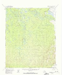
1952 Map of Kateel River A-1
USGS Topo · Published 1974About this map
Dulbi River winds through this interior Alaskan wilderness, as documented in 1952 via aerial photogrammetric methods. The landscape is defined by the intricate meandering of Holtnakatna Creek, which cuts through the southwestern and north-central portions of the quadrangle before eventually draining toward the larger river system. To the northeast, the smaller Cottonwood Creek feeds into a complex network of wetlands and small lakes. This survey primarily illustrates the hydrologic patterns and topography of the Kateel River Meridian before modern human intervention or development reached this area. The presence of unsurveyed and unmarked land lines, predetermined by the Bureau of Land Management, indicates a region that remained largely a frontier at the time of the 1950s mapping.
Find a feature on this map
3 named features on this map. Tap any name to fly to it.
Don’t see what you’re looking for? This feature index may not catch every label — zoom into the map to look around manually.
Map Details
Editions of this 1952 Kateel River A-1 Map
2 editions found
Other maps of this area

1945 · Nulato
USGS Topo · 1:250,000

1951 · Nulato
USGS Topo · 1:250,000

1951 · Ruby
USGS Topo · 1:250,000

1951 · Kateel River
USGS Topo · 1:250,000

1951 · Melozitna
USGS Topo · 1:250,000

1952 · Nulato D-1
USGS Topo · 1:63,360

1952 · Kateel River A-2
USGS Topo · 1:63,360

1952 · Ruby D-6
USGS Topo · 1:63,360

1952 · Kateel River A-1
USGS Topo · 1:63,360

1952 · Nulato D-2
USGS Topo · 1:63,360