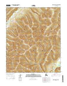
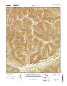
2015 Map of Kateel River A-5 NE
USGS Topo · Published 2015About this map
The Nulato Hills dominate this portion of the Alaskan interior, providing a stark topographical contrast between the high ridges and the winding river valleys below. In the northern section of the map, the Honhosa River carves through the terrain, while the Gisasa River appears in the southeastern corner, illustrating the complex drainage patterns of the Yukon-Koyukuk region. This 2015 survey reveals an unpopulated landscape defined by dramatic elevation changes, with numerous unnamed peaks and valleys characteristic of this part of the subarctic wilderness. The absence of roads or established settlements on this sheet highlights the isolation of the territory, where geography is dictated entirely by the natural courses of these remote waterways and the surrounding highlands.
Find a feature on this map
7 named features on this map. Tap any name to fly to it.
Don’t see what you’re looking for? This feature index may not catch every label — zoom into the map to look around manually.
Map Details
Editions of this 2015 Kateel River A-5 NE Map
This is the sole edition of this map. No revisions or reprints were ever made.
Other maps of this area

1951 · Kateel River
USGS Topo · 1:250,000

1952 · Kateel River A-4
USGS Topo · 1:63,360

1952 · Kateel River B-4
USGS Topo · 1:63,360
1952 · Kateel River A-5
USGS Topo · 1:63,360

1954 · Kateel River B-5
USGS Topo · 1:63,360
1954 · Kateel River A-5
USGS Topo · 1:63,360

1955 · Kateel River B-5
USGS Topo · 1:63,360

1955 · Kateel River
USGS Topo · 1:250,000
2015 · Kateel River B-4 SW
USGS Topo · 1:25,000
2015 · Kateel River B-5 SE
USGS Topo · 1:25,000