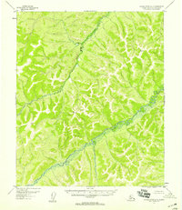
1952 Map of Kateel River A-5
USGS Topo · Published 1958About this map
Gisasa River and its tributary, the Honhosa River, dominate this interior Alaskan landscape as it appeared in the mid-1950s. The topography was mapped from 1952 aerial photographs and 1956 multiplex methods, showing a region defined entirely by its drainage systems and high points. Survey markers like VABM 2152 Nap and VABM 1919 Rain provide specific geodetic control points for researchers tracing early mapping efforts in the Fourth Judicial Division. There are no roads or trails indicated on the sheet, reflecting the area's isolation and reliance on natural waterways for movement. The map captures the intricate relief of the hills surrounding the river basins before any modern development or expanded terrestrial access reached this portion of the Kateel River quadrangle.
Find a feature on this map
4 named features on this map. Tap any name to fly to it.
Don’t see what you’re looking for? This feature index may not catch every label — zoom into the map to look around manually.
Map Details
Editions of this 1952 Kateel River A-5 Map
This is the sole edition of this map. No revisions or reprints were ever made.
Other maps of this area

1945 · Nulato
USGS Topo · 1:250,000

1951 · Nulato
USGS Topo · 1:250,000

1951 · Kateel River
USGS Topo · 1:250,000

1952 · Nulato D-5
USGS Topo · 1:63,360

1952 · Kateel River A-4
USGS Topo · 1:63,360

1952 · Nulato D-4
USGS Topo · 1:63,360

1952 · Nulato
USGS Topo · 1:250,000

1952 · Kateel River B-4
USGS Topo · 1:63,360

1954 · Kateel River B-5
USGS Topo · 1:63,360
1954 · Kateel River A-5
USGS Topo · 1:63,360