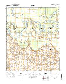
2015 Map of Kateel River B-3 NE
USGS Topo · Published 2015About this map
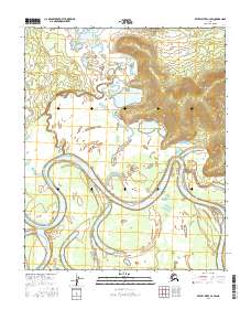
The Koyukuk River meanders sharply across this subarctic landscape, carving a complex network of oxbows and secondary channels through the Yukon-Koyukuk region. Large interior water bodies like Tachanlowa Lake and Nogadaneoda Lake dominate the low-lying terrain, illustrating the hydrologic shifts common to this river basin. The intricate drainage patterns are further defined by the Three Day Slough and Kozakakat Slough, which branch away from the main river course. This 2015 data reflects the primitive and largely roadless character of the Alaskan interior, where the natural water systems remain the primary geographic anchors within the surveyed boundaries of t1n r8e and t1n r9e.
Find a feature on this map
9 named features on this map. Tap any name to fly to it.
Don’t see what you’re looking for? This feature index may not catch every label — zoom into the map to look around manually.
Map Details
Editions of this 2015 Kateel River B-3 NE Map
This is the sole edition of this map. No revisions or reprints were ever made.
Other maps of this area

1951 · Kateel River
USGS Topo · 1:250,000

1952 · Kateel River B-3
USGS Topo · 1:63,360

1952 · Kateel River B-2
USGS Topo · 1:63,360

1954 · Kateel River C-2
USGS Topo · 1:63,360

1954 · Kateel River C-3
USGS Topo · 1:63,360

1955 · Kateel River
USGS Topo · 1:250,000
2015 · Kateel River C-3 SW
USGS Topo · 1:25,000
2015 · Kateel River B-3 SW
USGS Topo · 1:25,000
2015 · Kateel River B-3 NW
USGS Topo · 1:25,000
2016 · Kateel River C-2 SW
USGS Topo · 1:25,000