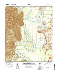
2015 Map of Kateel River B-4 SE
USGS Topo · Published 2015About this map
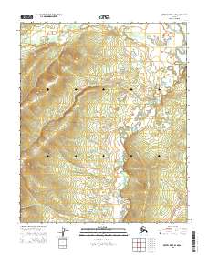
The Koyukuk River dominates this interior landscape, winding in broad meanders across the central valley. In the southern reaches, the Gisasa River feeds into this drainage system, while the Bitzla River enters from the east, illustrating the complex hydrological network of the Alaskan wilderness. The terrain is defined by sharp elevation changes along the western boundary, where the river valley meets the upland ridges of the Kateel River region. This 2015 survey, published by the U.S. Geological Survey, meticulously documents the shifting channels and sandbars of these major waterways, which have served as critical travel corridors for generations. The absence of roads or settlements underscores the untouched character of the Yukon-Koyukuk area, where the river remains the primary geographic anchor.
Find a feature on this map
12 named features on this map. Tap any name to fly to it.
Don’t see what you’re looking for? This feature index may not catch every label — zoom into the map to look around manually.
Map Details
Editions of this 2015 Kateel River B-4 SE Map
This is the sole edition of this map. No revisions or reprints were ever made.
Other maps of this area

1951 · Kateel River
USGS Topo · 1:250,000

1952 · Kateel River A-4
USGS Topo · 1:63,360

1952 · Kateel River A-3
USGS Topo · 1:63,360

1952 · Kateel River B-3
USGS Topo · 1:63,360

1952 · Kateel River B-4
USGS Topo · 1:63,360

1955 · Kateel River
USGS Topo · 1:250,000
2015 · Kateel River B-4 SW
USGS Topo · 1:25,000
2015 · Kateel River B-4 NE
USGS Topo · 1:25,000
2015 · Kateel River A-4 NW
USGS Topo · 1:25,000
2015 · Kateel River B-4 NW
USGS Topo · 1:25,000