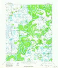
1954 Map of Kateel River D-1
USGS Topo · Published 1964About this map
The Koyukuk River dominates this mid-century interior landscape, winding in tight oxbows and massive loops through a dense network of sloughs and lakes. The river's meandering path has carved out significant landmasses, most notably Treat Island and Young Island, which are bounded by Treat Slough, Cutoff Slough, and Tom Cook Slough. These waterways suggest a seasonal and dynamic environment where the river channel constantly shifts, creating a labyrinth of secondary channels and wetlands.
Find a feature on this map
13 named features on this map. Tap any name to fly to it.
Don’t see what you’re looking for? This feature index may not catch every label — zoom into the map to look around manually.
Map Details
Editions of this 1954 Kateel River D-1 Map
2 editions found
Other maps of this area

1951 · Shungnak
USGS Topo · 1:250,000

1951 · Kateel River
USGS Topo · 1:250,000

1951 · Hughes
USGS Topo · 1:250,000

1951 · Melozitna
USGS Topo · 1:250,000

1954 · Kateel River C-2
USGS Topo · 1:63,360

1954 · Melozitna C-6
USGS Topo · 1:63,360

1954 · Kateel River C-1
USGS Topo · 1:63,360

1954 · Kateel River D-1
USGS Topo · 1:63,360

1954 · Melozitna D-6
USGS Topo · 1:63,360

1955 · Shungnak
USGS Topo · 1:250,000