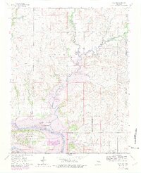
1964 Map of Kaw City
USGS Topo · Published 1979About this map
Arkansas River waters dominate this landscape, where the Osage Indian Reservation boundary meets the developing shoreline of Kaw Lake. This 1979 photorevision documents a period of significant transition for Kaw City and Washunga, showing the Planned Normal Pool 1010 that would eventually submerge large portions of the river valley. The map preserves the location of historic sites like Washunga Cem and Grand View Cem, along with the industrial footprint of a Quarry near the riverbank. Geographers and historians can trace the winding paths of Beaver Creek and Little Beaver Creek as they feed into the main waterway. The rugged elevation of the Longwood Hills and Big Hill provides a backdrop to the Old Railroad Grade and the settlement at Apperson, reflecting the area's rail and agricultural heritage before the landscape was altered by the reservoir.
Find a feature on this map
21 named features on this map. Tap any name to fly to it.
Don’t see what you’re looking for? This feature index may not catch every label — zoom into the map to look around manually.
Map Details
Editions of this 1964 Kaw City Map
4 editions found

Other maps of this area

1916 · Foraker
USGS Topo · 1:62,500

1932 · Fairfax
USGS Topo · 1:62,500

1935 · Kaw
USGS Topo · 1:62,500

1936 · Belford
USGS Topo · 1:62,500

1955 · Enid
USGS Topo · 1:250,000

1958 · Enid
USGS Topo · 1:250,000

1963 · Charley Creek
USGS Topo · 1:24,000

1963 · Uncas
USGS Topo · 1:24,000

1963 · Kaw City NW
USGS Topo · 1:24,000

1964 · Charley Creek NE
USGS Topo · 1:24,000