
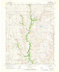
1963 Map of Kaw City NW
USGS Topo · Published 1965About this map
The Arkansas River meanders through the central corridor of this Oklahoma-Kansas borderland, defining a landscape of active watercourses and rural civic centers. Community life in the early 1960s is anchored by gathering places such as Tipton Community Hall and Deer Creek Community Hall, while the presence of School No 106 and Cooper Cem provides vital points of interest for genealogists tracing local family roots. The terrain is deeply etched by a network of tributaries including Chilocco Creek, Dry Creek, and Little Osage Creek, which feed into the main river valley.
Find a feature on this map
24 named features on this map. Tap any name to fly to it.
Don’t see what you’re looking for? This feature index may not catch every label — zoom into the map to look around manually.
Map Details
Editions of this 1963 Kaw City NW Map
This is the sole edition of this map. No revisions or reprints were ever made.
Other maps of this area

1889 · Burden
USGS Topo · 1:125,000

1890 · Wellington
USGS Topo · 1:125,000

1935 · Kaw
USGS Topo · 1:62,500

1955 · Wichita
USGS Topo · 1:250,000

1955 · Enid
USGS Topo · 1:250,000

1958 · Enid
USGS Topo · 1:250,000

1958 · Wichita
USGS Topo · 1:250,000

1963 · Uncas
USGS Topo · 1:24,000

1964 · Kaw City
USGS Topo · 1:24,000
1964 · Hardy
USGS Topo · 1:24,000