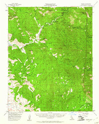
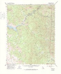
1957 Map of Kaweah
USGS Topo · Published 1961About this map
The Three Rivers area serves as a primary gateway to the high Sierra Nevada, where the converging branches of the Kaweah River carve through a landscape of prominent peaks and deep canyons. This 1957 field-checked survey reveals the early infrastructure of Sequoia National Park, centered on the Ash Mountain Natl Park Hdqrs. Local industry and land use are visible through features like the Good Hope Mines and the Tulare County Airport, while the rugged eastern terrain is dotted with remote outposts such as the Peck Cabin and South Fork Ranger Sta. Natural landmarks like Paradise Cave and Case Mountain define the high country, illustrating the region's character before modern development expanded into these foothills of the southern Sierra.
Find a feature on this map
71 named features on this map. Tap any name to fly to it.
Don’t see what you’re looking for? This feature index may not catch every label — zoom into the map to look around manually.
Map Details
Editions of this 1957 Kaweah Map
5 editions found
Other maps of this area

1903 · Tehipite
USGS Topo · 1:125,000

1904 · Kaweah
USGS Topo · 1:125,000

1905 · Tehipite
USGS Topo · 1:125,000

1909 · Kaweah
USGS Topo · 1:125,000

1922 · Trimmer
USGS Topo · 1:96,000

1924 · Dinuba
USGS Topo · 1:125,000

1925 · Rocky Hill
USGS Topo · 1:31,680

1927 · Rocky Hill
USGS Topo · 1:31,680

1928 · Lemon Cove
USGS Topo · 1:31,680

1928 · Lindsay
USGS Topo · 1:31,680