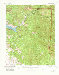
1957 Map of Kaweah
USGS Topo · Published 1973About this map
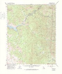
Three Rivers serves as the focal point of this mid-century survey, situated at the confluence where the multiple forks of the Kaweah River descend from the high Sierra Nevada. The landscape is defined by the transition from the Yokohl Valley floor to the high ridges of Sequoia National Park. The recent creation of Lake Kaweah is a prominent feature, including its Boat Ramp and Campground, illustrating the era's focus on water management and recreation.
Find a feature on this map
73 named features on this map. Tap any name to fly to it.
Don’t see what you’re looking for? This feature index may not catch every label — zoom into the map to look around manually.
Map Details
Editions of this 1957 Kaweah Map
5 editions found
Other maps of this area

1903 · Tehipite
USGS Topo · 1:125,000

1904 · Kaweah
USGS Topo · 1:125,000

1905 · Tehipite
USGS Topo · 1:125,000

1909 · Kaweah
USGS Topo · 1:125,000

1922 · Trimmer
USGS Topo · 1:96,000

1924 · Dinuba
USGS Topo · 1:125,000

1925 · Rocky Hill
USGS Topo · 1:31,680

1927 · Rocky Hill
USGS Topo · 1:31,680

1928 · Lemon Cove
USGS Topo · 1:31,680

1928 · Lindsay
USGS Topo · 1:31,680