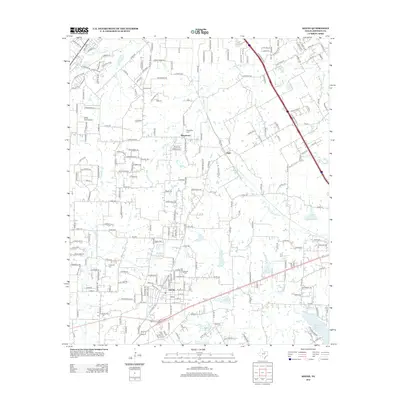
2012 Map of Keene
USGS Topo · Published 2012About this map
Keene serves as the focal point of this Johnson County landscape, anchored by the campus of Southwestern Adventist Univ. The town's grid is dense with residential streets such as W Oakdale St and E Red Deer Rd, reflecting its growth as a regional educational hub. To the north and east, the unincorporated communities of Marystown and Egan maintain a more dispersed character, linked by a network of county roads like Co RD-805 and Co RD-702.
Find a feature on this map
169 named features on this map. Tap any name to fly to it.
Don’t see what you’re looking for? This feature index may not catch every label — zoom into the map to look around manually.
Map Details
Editions of this 2012 Keene Map
This is the sole edition of this map. No revisions or reprints were ever made.
Other maps of this area

1891 · Cleburne
USGS Topo · 1:125,000

1894 · Cleburne
USGS Topo · 1:125,000

1894 · Fort Worth
USGS Topo · 1:125,000

1954 · Dallas
USGS Topo · 1:250,000

1955 · Burleson
USGS Topo · 1:24,000

1955 · Primrose
USGS Topo · 1:24,000

1958 · Dallas
USGS Topo · 1:250,000

1959 · Mansfield
USGS Topo · 1:24,000
1959 · Arlington
USGS Topo · 1:62,500

1960 · Keene
USGS Topo · 1:24,000