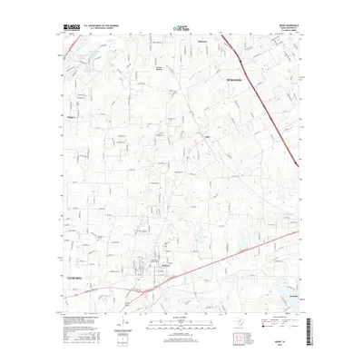
2016 Map of Keene
USGS Topo · Published 2016About this map
Keene serves as a central focal point in this portion of Johnson County, anchored by the presence of Southwestern Adventist University. The surrounding landscape is defined by the headwaters of several drainages, including Quil Miller Creek and the North Fork Chambers Creek, which carve through the terrain between developing residential pockets and established settlements. To the north, the growing suburban footprint of Burleson and Briaroaks meets more rural stretches like Cross Timber and the community of Egan. Local history is preserved at the Marystown Cemetery and Hopewell Cemetery, while the northern portion of the map features leisure and infrastructure landmarks such as Mountain Valley Lake Number 1 and the specialized STOL Field. The map illustrates a distinctive Texas landscape where academic institutions and small-town centers are increasingly connected by a complex web of county roads and farm-to-market routes.
Find a feature on this map
181 named features on this map. Tap any name to fly to it.
Don’t see what you’re looking for? This feature index may not catch every label — zoom into the map to look around manually.
Map Details
Editions of this 2016 Keene Map
This is the sole edition of this map. No revisions or reprints were ever made.
Other maps of this area

1891 · Cleburne
USGS Topo · 1:125,000

1894 · Cleburne
USGS Topo · 1:125,000

1894 · Fort Worth
USGS Topo · 1:125,000

1954 · Dallas
USGS Topo · 1:250,000

1955 · Burleson
USGS Topo · 1:24,000

1955 · Primrose
USGS Topo · 1:24,000

1958 · Dallas
USGS Topo · 1:250,000

1959 · Mansfield
USGS Topo · 1:24,000
1959 · Arlington
USGS Topo · 1:62,500

1960 · Keene
USGS Topo · 1:24,000