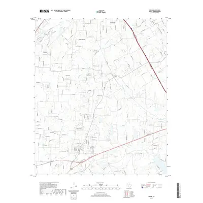
2019 Map of Keene
USGS Topo · Published 2019About this map
The city of Keene serves as the primary hub for this portion of Johnson County, anchored by its namesake Keene Cem and a dense residential grid. The landscape is defined by the headwaters of several critical North Texas drainages, including Quil Miller Cr and the N Fork Chambers Cr, which carve through the terrain as it transitions from the suburban development of Briaroaks to more dispersed rural clusters.
Find a feature on this map
182 named features on this map. Tap any name to fly to it.
Don’t see what you’re looking for? This feature index may not catch every label — zoom into the map to look around manually.
Map Details
Editions of this 2019 Keene Map
This is the sole edition of this map. No revisions or reprints were ever made.
Other maps of this area

1891 · Cleburne
USGS Topo · 1:125,000

1894 · Cleburne
USGS Topo · 1:125,000

1894 · Fort Worth
USGS Topo · 1:125,000

1954 · Dallas
USGS Topo · 1:250,000

1955 · Burleson
USGS Topo · 1:24,000

1955 · Primrose
USGS Topo · 1:24,000

1958 · Dallas
USGS Topo · 1:250,000

1959 · Mansfield
USGS Topo · 1:24,000
1959 · Arlington
USGS Topo · 1:62,500

1960 · Keene
USGS Topo · 1:24,000