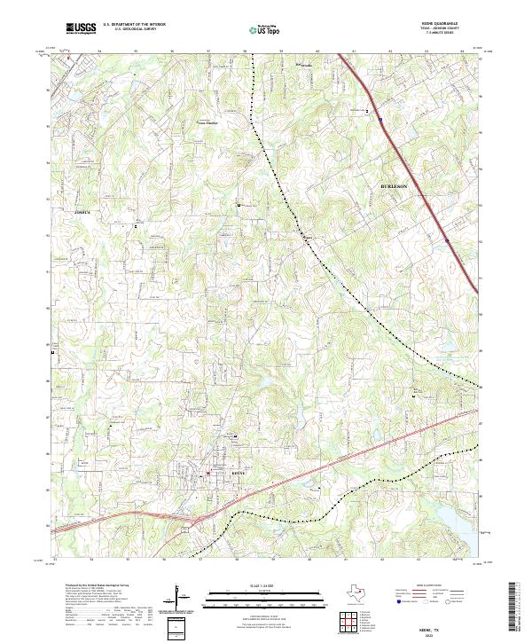
2022 Map of Keene
USGS Topo · Published 2022About this map
Keene serves as the focal point of this Johnson County landscape, characterized by the institutional presence of Southwestern Adventist University at its center. The area reflects a transition from rural homesteads to expanding residential corridors between Burleson and Joshua. Numerous burial grounds are scattered throughout the territory, including Marystown Cem, Union Hill Cem, and Hopewell Cem, offering vital touchpoints for genealogical research. The topography is defined by the drainage systems of Quil Miller Cr and the N Fork Chambers Cr, while the Soil Conservation Service Site 30 Reservoir provides a significant water management feature. Smaller communities like Egan and Cross Timber maintain their identities amidst the network of county roads and state highways that connect the northern and southern portions of the county.
Find a feature on this map
196 named features on this map. Tap any name to fly to it.
Don’t see what you’re looking for? This feature index may not catch every label — zoom into the map to look around manually.
Map Details
Editions of this 2022 Keene Map
This is the sole edition of this map. No revisions or reprints were ever made.
Other maps of this area

1891 · Cleburne
USGS Topo · 1:125,000

1894 · Cleburne
USGS Topo · 1:125,000

1894 · Fort Worth
USGS Topo · 1:125,000

1954 · Dallas
USGS Topo · 1:250,000

1955 · Burleson
USGS Topo · 1:24,000

1955 · Primrose
USGS Topo · 1:24,000

1958 · Dallas
USGS Topo · 1:250,000

1959 · Mansfield
USGS Topo · 1:24,000
1959 · Arlington
USGS Topo · 1:62,500

1960 · Keene
USGS Topo · 1:24,000