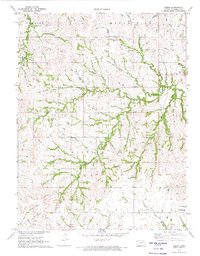
1971 Map of Keene
USGS Topo · Published 1974About this map
Keene serves as the central hub of this eastern Wabaunsee County landscape, where the headwaters of several significant drainage systems converge. The terrain is defined by the intricately carved valleys of Mission Creek and its various tributaries, including the North Branch, Middle Branch, and South Branch. These waterways, along with Higby Creek and Johnson Creek, create a deeply dissected topography typical of the Flint Hills region.
Find a feature on this map
22 named features on this map. Tap any name to fly to it.
Don’t see what you’re looking for? This feature index may not catch every label — zoom into the map to look around manually.
Map Details
Editions of this 1971 Keene Map
2 editions found
Other maps of this area

1885 · Eskridge
USGS Topo · 1:125,000

1889 · Burlingame
USGS Topo · 1:125,000

1889 · Wamego
USGS Topo · 1:125,000

1889 · Eskridge
USGS Topo · 1:125,000

1889 · Topeka
USGS Topo · 1:125,000

1894 · Eskridge
USGS Topo · 1:125,000

1894 · Burlingame
USGS Topo · 1:125,000

1894 · Topeka
USGS Topo · 1:125,000

1894 · Wamego
USGS Topo · 1:125,000

1947 · Lawrence
USGS Topo · 1:250,000