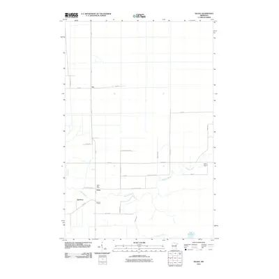
2010 Map of Kelsey
USGS Topo · Published 2010About this map
The Whiteface River meanders across this northern Minnesota landscape, defining the character of the settlements at Kelsey and Dumblane. In this part of Saint Louis County, the transition from wetland to upland is marked by a network of drainage channels including Joki Creek, Deadman's Creek, and Jenkins Creek. Local community life is anchored by the Kelsey Post Office and the Riverside Cemetery, located near the intersection of HWY-7 and HWY-29. Farther north, the small siding of Sax sits along the roadway, while the Cotton Lookout Tower stands as a prominent landmark to the east. The dominance of family-named roads like Erickson Rd, McKay Rd, and Moberg Rd reflects the rural, parcel-based development of the region. This survey captures a snapshot of the area's hydrology and human footprint, centered around the Lake Williams basin.
Find a feature on this map
28 named features on this map. Tap any name to fly to it.
Don’t see what you’re looking for? This feature index may not catch every label — zoom into the map to look around manually.
Map Details
Editions of this 2010 Kelsey Map
This is the sole edition of this map. No revisions or reprints were ever made.
Other maps of this area

1951 · Central Lakes
USGS Topo · 1:24,000

1951 · Zim
USGS Topo · 1:24,000

1951 · Casco
USGS Topo · 1:24,000

1953 · Canyon
USGS Topo · 1:24,000

1953 · Payne
USGS Topo · 1:24,000

1954 · Hibbing
USGS Topo · 1:250,000

1956 · Cotton
USGS Topo · 1:24,000

1957 · Hibbing
USGS Topo · 1:250,000

1958 · Hibbing
USGS Topo · 1:250,000

1963 · Meadowlands NW
USGS Topo · 1:24,000