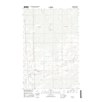
2016 Map of Kelsey
USGS Topo · Published 2016About this map
The Whiteface River meanders through the heart of this Saint Louis County landscape, defining the hydrology of a region where small settlements like Kelsey and Sax established roots along the riverbanks and early road corridors. To the southwest, the community of Dumblane sits near the river's bend, where local history is anchored at the Riverside Cem. The terrain is crisscrossed by numerous waterways, including Jenkins Cr, Deadmans Cr, and Joki Cr, which feed into the larger river system and create a complex wetland environment. These natural features dictated the placement of long-standing county routes like Arkola Rd and Co Hwy 52. Toward the southeast, the small Lake Williams provides a distinct landmark in an otherwise low-lying, water-rich territory that reflects the late-period land use and drainage patterns of northern Minnesota.
Find a feature on this map
31 named features on this map. Tap any name to fly to it.
Don’t see what you’re looking for? This feature index may not catch every label — zoom into the map to look around manually.
Map Details
Editions of this 2016 Kelsey Map
This is the sole edition of this map. No revisions or reprints were ever made.
Other maps of this area

1951 · Central Lakes
USGS Topo · 1:24,000

1951 · Zim
USGS Topo · 1:24,000

1951 · Casco
USGS Topo · 1:24,000

1953 · Canyon
USGS Topo · 1:24,000

1953 · Payne
USGS Topo · 1:24,000

1954 · Hibbing
USGS Topo · 1:250,000

1956 · Cotton
USGS Topo · 1:24,000

1957 · Hibbing
USGS Topo · 1:250,000

1958 · Hibbing
USGS Topo · 1:250,000

1963 · Meadowlands NW
USGS Topo · 1:24,000