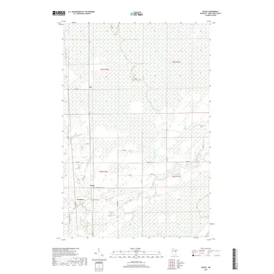
2019 Map of Kelsey
USGS Topo · Published 2019About this map
Kelsey and the small settlement of Sax anchor this survey of Saint Louis County, documenting a landscape defined by meandering watercourses and extensive wetlands. The Whiteface River snakes through the southern portion of the quadrangle, joined by tributaries such as Jenkins Cr and Deadman's Cr. This 2019 data reflects the modern rural infrastructure of the region, where a grid of county roads, including Co Rd 7 and Co Hwy 52, provides access through the low-lying terrain. To the west of the river, Riverside Cem and the locality of Dumblane offer specific points of interest for genealogists tracing family roots in this northern Minnesota river valley. The map clearly delineates township and range boundaries like t55n r18w and t54n r17w, which are essential for property research and understanding the historical division of these wooded lands.
Find a feature on this map
31 named features on this map. Tap any name to fly to it.
Don’t see what you’re looking for? This feature index may not catch every label — zoom into the map to look around manually.
Map Details
Editions of this 2019 Kelsey Map
This is the sole edition of this map. No revisions or reprints were ever made.
Other maps of this area

1951 · Central Lakes
USGS Topo · 1:24,000

1951 · Zim
USGS Topo · 1:24,000

1951 · Casco
USGS Topo · 1:24,000

1953 · Canyon
USGS Topo · 1:24,000

1953 · Payne
USGS Topo · 1:24,000

1954 · Hibbing
USGS Topo · 1:250,000

1956 · Cotton
USGS Topo · 1:24,000

1957 · Hibbing
USGS Topo · 1:250,000

1958 · Hibbing
USGS Topo · 1:250,000

1963 · Meadowlands NW
USGS Topo · 1:24,000