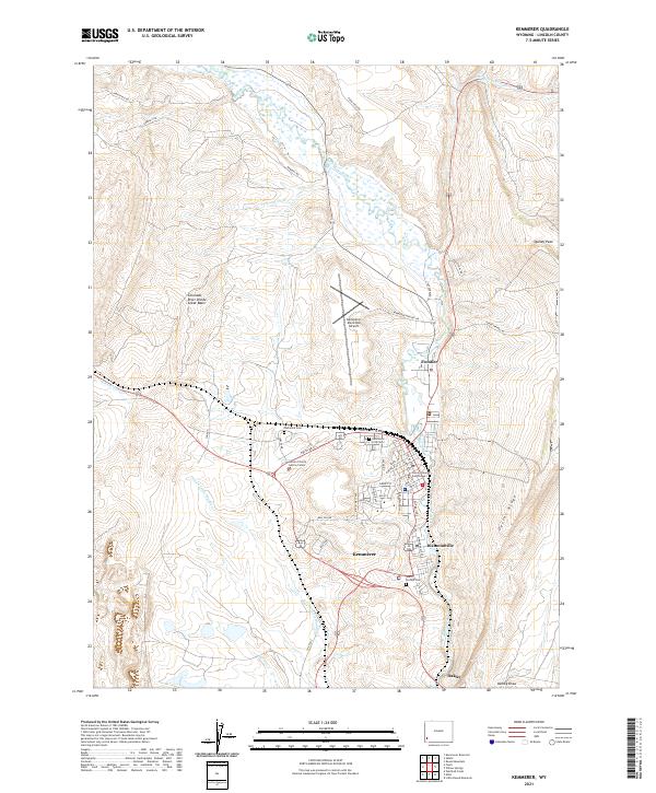
2021 Map of Kemmerer
USGS Topo · Published 2021About this map
Kemmerer and the adjacent community of Diamondville serve as the central hubs of this industrial and administrative landscape along the banks of Hams Fork. The area's function as a regional seat is anchored by the Lincoln County Courthouse and the Lincoln County Justice Center, situated near the residential core. The topography is defined by the striking Oyster Ridge to the east and the Colorado River Divide Great Basin to the west, creating a corridor for both water and transport. Further north, the settlement of Frontier sits along the river, while several burial grounds, including Hamsfork Cem and South Lincoln Cem, are located on the periphery of the main townships. This survey illustrates the modern layout of these mining-heritage towns, with a clear grid of streets like Opal St and Diamondville Ave meeting the open spaces of Peternal Draw.
Find a feature on this map
49 named features on this map. Tap any name to fly to it.
Don’t see what you’re looking for? This feature index may not catch every label — zoom into the map to look around manually.
Map Details
Editions of this 2021 Kemmerer Map
This is the sole edition of this map. No revisions or reprints were ever made.
Other maps of this area

1954 · Ogden
USGS Topo · 1:250,000

1954 · Kemmerer
USGS Topo · 1:62,500

1958 · Ogden
USGS Topo · 1:250,000

1960 · Ogden
USGS Topo · 1:250,000

1962 · Elkol
USGS Topo · 1:24,000

1962 · Warfield Creek
USGS Topo · 1:24,000

1969 · Willow Springs
USGS Topo · 1:24,000
1969 · Round Mountain
USGS Topo · 1:24,000
1969 · Little Round Mountain
USGS Topo · 1:24,000
1979 · Kemmerer
USGS Topo · 1:100,000