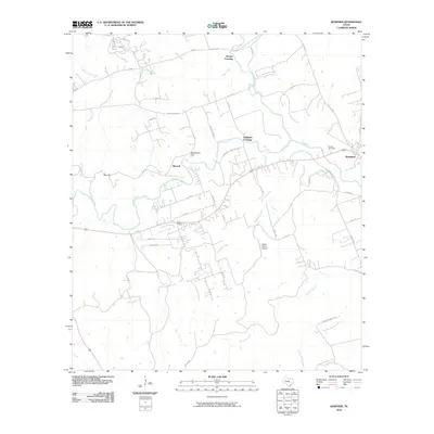
2010 Map of Kempner
USGS Topo · Published 2010About this map
Kempner and the nearby settlement of Shortall occupy the eastern stretches of this Lampasas County landscape, where the Lampasas River and Sulphur Creek converge. The terrain is defined by its drainage network, with seasonal waterways like Mesquite Creek, Road Hollow Creek, and Lucy Creek carving through the countryside. Local transit is managed via a series of crossings and cuts, such as Brooks Crossing, Hallmark Crossing, and the evocatively named Deadmans Cut and Blue Cut, which likely represent early road or topographic modifications.
Find a feature on this map
51 named features on this map. Tap any name to fly to it.
Don’t see what you’re looking for? This feature index may not catch every label — zoom into the map to look around manually.
Map Details
Editions of this 2010 Kempner Map
This is the sole edition of this map. No revisions or reprints were ever made.
Other maps of this area

1887 · Lampasas
USGS Topo · 1:125,000

1887 · Burnet
USGS Topo · 1:125,000

1893 · Georgetown
USGS Topo · 1:125,000

1893 · Burnet
USGS Topo · 1:125,000

1894 · Lampasas
USGS Topo · 1:125,000

1894 · Gatesville
USGS Topo · 1:125,000

1903 · Burnet
USGS Topo · 1:125,000

1909 · Burnet
USGS Topo · 1:125,000

1947 · Fort Hood
USGS Topo · 1:62,500

1947 · Twin Moutains
USGS Topo · 1:24,000