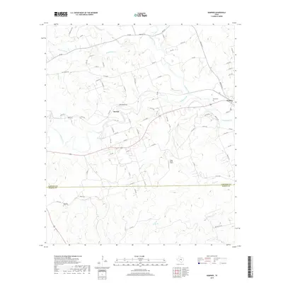
2019 Map of Kempner
USGS Topo · Published 2019About this map
Kempner serves as the primary hub of this Central Texas landscape, situated where the Lampasas River and Sulphur Creek converge. The topography is defined by the winding paths of these waterways and their numerous tributaries, including Lucy Cr and Road Hollow Cr, which have carved distinctive features into the terrain like Deadmans Cut and Blue Cut. The map reveals a transition from the structured street grid of the settlement to a more dispersed rural pattern of farms and ranches connected by an extensive network of county roads and farm-to-market routes.
Find a feature on this map
76 named features on this map. Tap any name to fly to it.
Don’t see what you’re looking for? This feature index may not catch every label — zoom into the map to look around manually.
Map Details
Editions of this 2019 Kempner Map
This is the sole edition of this map. No revisions or reprints were ever made.
Other maps of this area

1887 · Lampasas
USGS Topo · 1:125,000

1887 · Burnet
USGS Topo · 1:125,000

1893 · Georgetown
USGS Topo · 1:125,000

1893 · Burnet
USGS Topo · 1:125,000

1894 · Lampasas
USGS Topo · 1:125,000

1894 · Gatesville
USGS Topo · 1:125,000

1903 · Burnet
USGS Topo · 1:125,000

1909 · Burnet
USGS Topo · 1:125,000

1947 · Fort Hood
USGS Topo · 1:62,500

1947 · Twin Moutains
USGS Topo · 1:24,000