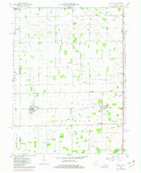
1960 Map of Kempton
USGS Topo · Published 1980About this map
The Indian Treaty Boundary bisects the southern portion of this landscape, a remnant of early 19th-century land divisions that still influenced property lines into the 1960s. This agricultural region at the junction of Tipton, Clinton, and Howard counties is anchored by the railroad settlement of Kempton, where Storage Bins and a rail line now marked Norfolk and Western reflect the area’s grain-handling economy. To the east, the small community of Goldsmith sits near the Twp Sch and Wolford Cem, while the historic hamlet of Tetersburg occupies the southeastern corner.
Find a feature on this map
47 named features on this map. Tap any name to fly to it.
Don’t see what you’re looking for? This feature index may not catch every label — zoom into the map to look around manually.
Map Details
Editions of this 1960 Kempton Map
2 editions found
Other maps of this area

1953 · Danville
USGS Topo · 1:250,000

1955 · Danville
USGS Topo · 1:250,000

1956 · Danville
USGS Topo · 1:250,000

1960 · Kokomo West
USGS Topo · 1:24,000

1960 · Kokomo East
USGS Topo · 1:24,000

1960 · Kempton
USGS Topo · 1:24,000

1960 · Tipton
USGS Topo · 1:24,000

1961 · Russiaville
USGS Topo · 1:24,000

1961 · Sheridan
USGS Topo · 1:24,000

1961 · Hillisburg
USGS Topo · 1:24,000