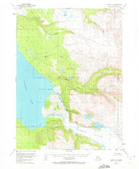
1951 Map of Kenai A-2
USGS Topo · Published 1972About this map
The Kenai National Moose Range dominates this landscape, showing a preserved wilderness on the Kenai Peninsula in the early 1950s. The map is defined by the massive presence of Tustumena Lake, which is fed by the dramatic Tustumena Glacier and Glacier Creek at its southeastern edge. The drainage patterns of the Funny River and Bear Creek illustrate the glacial hydrology of the region, while the Seward Base Line provides a primary surveying reference point across the rugged interior. Small signs of human presence are sparse, indicated only by isolated Cabin and Cabins labels, suggesting seasonal trapping or hunting use in an era before significant road development reached this part of the peninsula. The transition from the alluvial flats of Moose Creek to the high alpine elevations near Indian Creek highlights the varied topography of this protected subarctic environment.
Find a feature on this map
16 named features on this map. Tap any name to fly to it.
Don’t see what you’re looking for? This feature index may not catch every label — zoom into the map to look around manually.
Map Details
Editions of this 1951 Kenai A-2 Map
5 editions found
Other maps of this area

1944 · Kenai
USGS Topo · 1:250,000

1950 · Kenai
USGS Topo · 1:250,000

1950 · Kenai B-1
USGS Topo · 1:63,360

1950 · Seldovia D-2
USGS Topo · 1:63,360

1950 · Kenai B-3
USGS Topo · 1:63,360

1951 · Seldovia
USGS Topo · 1:250,000

1951 · Seldovia D-3
USGS Topo · 1:63,360

1951 · Kenai B-2
USGS Topo · 1:63,360

1951 · Kenai A-3
USGS Topo · 1:63,360

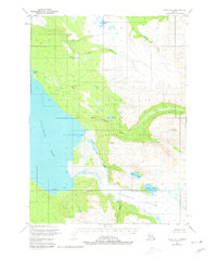
1951 · Kenai A-2
USGS Topo · 1:63,360