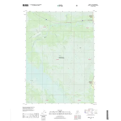
2017 Map of Kenai B-1 NE
USGS Topo · Published 2017About this map
Cooper Landing serves as the primary settlement hub in this 2017 study of the Kenai Peninsula, situated where the Kenai River begins its journey through the heart of the region. The landscape is defined by the intersection of the Chugach National Forest and the Kenai National Wildlife Refuge, illustrating a territory dedicated to conservation and backcountry recreation. Transportation and access are anchored by the Sterling Highway and Skilak Lake Road, while an extensive network of trails like the Fuller Lakes Trail and Suprise Creek Trail provides access to high-elevation landmarks such as Russian Mtn and Bear Mtn. The hydrology of the area is particularly complex, featuring the deep Kenai River Canyon, the braided waters of the Skilak River, and coastal features like Doroshin Bay and the Irish Channel near Lucas Island.
Find a feature on this map
27 named features on this map. Tap any name to fly to it.
Don’t see what you’re looking for? This feature index may not catch every label — zoom into the map to look around manually.
Map Details
Editions of this 2017 Kenai B-1 NE Map
This is the sole edition of this map. No revisions or reprints were ever made.
Other maps of this area

1944 · Kenai
USGS Topo · 1:250,000

1950 · Kenai
USGS Topo · 1:250,000

1950 · Kenai B-1
USGS Topo · 1:63,360

1951 · Seward
USGS Topo · 1:250,000

1951 · Kenai C-1
USGS Topo · 1:63,360

1951 · Seward C-8
USGS Topo · 1:63,360

1951 · Seward B-8
USGS Topo · 1:63,360

1952 · Kenai C-1
USGS Topo · 1:63,360

1952 · Kenai B-1
USGS Topo · 1:63,360

1952 · Seward C-8
USGS Topo · 1:63,360