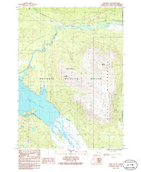
1986 Map of Kenai B-1 NE
USGS Topo · Published 1986About this map
The Kenai River winds through the heart of the Kenai National Wildlife Refuge in this 1980s landscape, captured just as the region’s wilderness boundaries were being formalised. The map details the transition from the fast-moving waters of the Kenai River Canyon into the expansive Skilak Lake, where features like Doroshin Bay and the Irish Channel around Lucas Island define the shoreline.
Find a feature on this map
24 named features on this map. Tap any name to fly to it.
Don’t see what you’re looking for? This feature index may not catch every label — zoom into the map to look around manually.
Map Details
Editions of this 1986 Kenai B-1 NE Map
This is the sole edition of this map. No revisions or reprints were ever made.
Other maps of this area

1944 · Kenai
USGS Topo · 1:250,000

1950 · Kenai
USGS Topo · 1:250,000

1950 · Kenai B-1
USGS Topo · 1:63,360

1951 · Seward
USGS Topo · 1:250,000

1951 · Kenai C-1
USGS Topo · 1:63,360

1951 · Seward C-8
USGS Topo · 1:63,360

1951 · Seward B-8
USGS Topo · 1:63,360

1952 · Kenai C-1
USGS Topo · 1:63,360

1952 · Kenai B-1
USGS Topo · 1:63,360

1952 · Seward C-8
USGS Topo · 1:63,360