
1951 Map of Kenai C-4
USGS Topo · Published 1965About this map
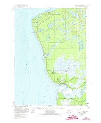
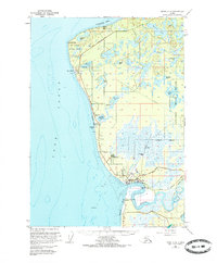
Kenai sits at the mouth of the Kenai River along the eastern shore of Cook Inlet in this 1951 survey, which shows the settlement just before the mid-century oil boom transformed the region. The map documents an economy rooted in natural resources and mid-century infrastructure, featuring a Cannery at the river's edge, a Sawmill near the coast, and a Radio Tower signaling its growing importance as a transportation hub. A large Military Reservation and Wildwood Station dominate the central landscape, while the Kenai Moose Range National Wildlife Refuge borders the inland lakes to the east.
Find a feature on this map
37 named features on this map. Tap any name to fly to it.
Don’t see what you’re looking for? This feature index may not catch every label — zoom into the map to look around manually.
Map Details
Editions of this 1951 Kenai C-4 Map
3 editions found
Other maps of this area

1944 · Kenai
USGS Topo · 1:250,000

1950 · Kenai
USGS Topo · 1:250,000

1950 · Kenai C-3
USGS Topo · 1:63,360

1950 · Kenai B-3
USGS Topo · 1:63,360

1950 · Kenai D-4
USGS Topo · 1:63,360

1951 · Kenai D-3
USGS Topo · 1:63,360

1951 · Kenai C-3
USGS Topo · 1:63,360

1951 · Kenai B-4
USGS Topo · 1:63,360

1952 · Kenai D-3
USGS Topo · 1:63,360

1952 · Kenai D-4
USGS Topo · 1:63,360