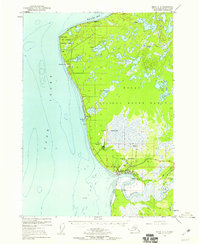
1952 Map of Kenai C-4
USGS Topo · Published 1959About this map
Kenai serves as the focal point for this mid-century coastal survey, situated where the Kenai River meets the waters of Cook Inlet. The landscape reflects a mix of traditional industry and Cold War era expansion, featuring a Sawmill, multiple storage tanks, and a large Military Reservation that occupies much of the central coastline. Aviation and communication infrastructure is prominent, with the Kenai Airport, a Radio Range Station, and a Radio Tower marking the settlement's growth as a regional hub.
Find a feature on this map
32 named features on this map. Tap any name to fly to it.
Don’t see what you’re looking for? This feature index may not catch every label — zoom into the map to look around manually.
Map Details
Editions of this 1952 Kenai C-4 Map
3 editions found

Other maps of this area

1944 · Kenai
USGS Topo · 1:250,000

1950 · Kenai
USGS Topo · 1:250,000

1950 · Kenai C-3
USGS Topo · 1:63,360

1950 · Kenai B-3
USGS Topo · 1:63,360

1950 · Kenai D-4
USGS Topo · 1:63,360

1951 · Kenai D-3
USGS Topo · 1:63,360

1951 · Kenai C-4
USGS Topo · 1:63,360

1951 · Kenai C-3
USGS Topo · 1:63,360

1951 · Kenai B-4
USGS Topo · 1:63,360

1952 · Kenai D-3
USGS Topo · 1:63,360