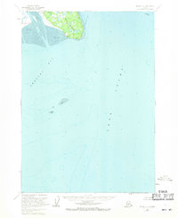
1958 Map of Kenai C-5
USGS Topo · Published 1971About this map
Cook Inlet dominates this coastal survey, where the dynamic meeting of glacial waters and tidal forces shapes the western shoreline of the Kenai Peninsula. The landscape is defined by the expansive tidal flats of Redoubt Bay and Trading Bay, separated by the prominent headland of West Foreland. At the edge of these mudflats lies the small settlement of Kustatan, positioned near the mouth of the Kustatan River. Further inland, a lone Cabin and the geological marker of Anutruin Rock punctuate the sparsely inhabited terrain. Emerging industrial activity is visible in the deeper waters of the inlet, represented by the Oil Platform Dillon, signaling the mid-century expansion of resource extraction in the region. This 1958 field-annotated study captures the precarious balance between a traditional Alaskan wilderness and the early infrastructure of the modern energy era.
Find a feature on this map
10 named features on this map. Tap any name to fly to it.
Don’t see what you’re looking for? This feature index may not catch every label — zoom into the map to look around manually.
Map Details
Editions of this 1958 Kenai C-5 Map
2 editions found
Other maps of this area

1944 · Kenai
USGS Topo · 1:250,000

1950 · Kenai
USGS Topo · 1:250,000

1950 · Kenai D-4
USGS Topo · 1:63,360

1951 · Kenai C-4
USGS Topo · 1:63,360

1951 · Kenai B-4
USGS Topo · 1:63,360

1952 · Kenai D-4
USGS Topo · 1:63,360

1952 · Kenai C-4
USGS Topo · 1:63,360

1952 · Kenai B-4
USGS Topo · 1:63,360

1958 · Kenai C-5
USGS Topo · 1:63,360

1958 · Kenai D-5
USGS Topo · 1:63,360