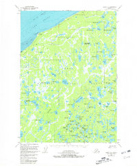
1951 Map of Kenai D-2
USGS Topo · Published 1981About this map
Cook Inlet defines the northern edge of this coastal Alaskan landscape, where tidal flats and a prominent shoal give way to a dense network of subarctic lakes and wetlands. Much of the interior is protected within the Kenai National Moose Range, reflecting the federal conservation priorities of the mid-20th century. While largely unsettled, the presence of isolated cabins and a cabin near the coast suggests seasonal use by trappers or hunters.
Find a feature on this map
98 named features on this map. Tap any name to fly to it.
Don’t see what you’re looking for? This feature index may not catch every label — zoom into the map to look around manually.
Map Details
Editions of this 1951 Kenai D-2 Map
3 editions found
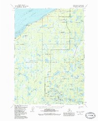
Other maps of this area

1944 · Kenai
USGS Topo · 1:250,000

1949 · Tyonek
USGS Topo · 1:250,000

1950 · Kenai
USGS Topo · 1:250,000

1950 · Kenai C-3
USGS Topo · 1:63,360

1951 · Tyonek
USGS Topo · 1:250,000

1951 · Kenai D-3
USGS Topo · 1:63,360

1951 · Kenai C-1
USGS Topo · 1:63,360

1951 · Kenai C-2
USGS Topo · 1:63,360

1951 · Kenai D-1
USGS Topo · 1:63,360

1951 · Kenai D-2
USGS Topo · 1:63,360