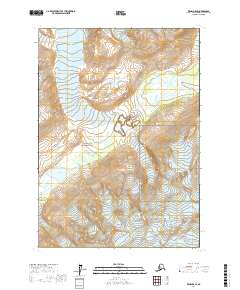
2017 Map of Kenai D-8 SE
USGS Topo · Published 2017About this map
Lake Clark National Park forms the heart of this high-latitude survey, where massive ice fields and narrow mountain passes dictate the landscape's character. The Aleutian Range dominates the terrain, punctuated by the Lake Clark Pass, which serves as a vital natural corridor between glacial peaks. The movement of ice is a defining feature of the area, with the Tanaina Glacier in the north and the Double Glacier and Aho Glacier in the south continuing to carve the surrounding valleys. Waterways like the North Fork Big River and Tlikakila River drain these icy heights, eventually pooling in alpine basins such as Summit Lake. This map represents a modern snapshot of a wilderness largely untouched by development, focusing instead on the dramatic geological and hydrological processes of the region.
Find a feature on this map
13 named features on this map. Tap any name to fly to it.
Don’t see what you’re looking for? This feature index may not catch every label — zoom into the map to look around manually.
Map Details
Editions of this 2017 Kenai D-8 SE Map
This is the sole edition of this map. No revisions or reprints were ever made.
Other maps of this area

1944 · Kenai
USGS Topo · 1:250,000

1950 · Kenai
USGS Topo · 1:250,000

1958 · Kenai D-8
USGS Topo · 1:63,360

1958 · Kenai C-8
USGS Topo · 1:63,360

1958 · Kenai D-7
USGS Topo · 1:63,360

1958 · Kenai C-7
USGS Topo · 1:63,360

1958 · Kenai
USGS Topo · 1:250,000
2017 · Kenai D-8 NW
USGS Topo · 1:25,000
2017 · Kenai D-7 NW
USGS Topo · 1:25,000
2017 · Kenai D-8 SW
USGS Topo · 1:25,000