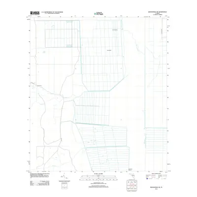
2012 Map of Kenansville NE
USGS Topo · Published 2012About this map
Mulberry Mound anchors the southeastern landscape of this Florida interior, where the upper Saint Johns River defines the marshy character of the terrain. The map depicts an intricate network of drainage canals and property divisions typical of the region’s agricultural development, particularly evident around Tenmile Ranch. These man-made water management systems contrast with the winding natural courses of Tenmile Cr and Wolf Cr. Small rises in the low-lying wetlands are identified as islands, including Camp Island and Jug Island, which historically provided dry ground amidst the seasonal fluctuations of the river basin. Transportation is limited to a few arterial routes such as Ten Mile Rd and W Malabar Rd, reflecting the rural and sparsely settled nature of this part of Brevard County at the start of the twenty-first century.
Find a feature on this map
10 named features on this map. Tap any name to fly to it.
Don’t see what you’re looking for? This feature index may not catch every label — zoom into the map to look around manually.
Map Details
Editions of this 2012 Kenansville NE Map
This is the sole edition of this map. No revisions or reprints were ever made.
Other maps of this area

1949 · Melbourne West
USGS Topo · 1:24,000

1951 · Melbourne West
USGS Topo · 1:24,000

1953 · Fellsmere SW
USGS Topo · 1:24,000

1953 · Fellsmere NW
USGS Topo · 1:24,000

1953 · Kenansville SW
USGS Topo · 1:24,000

1953 · Deer Park SE
USGS Topo · 1:24,000

1953 · Kenansville
USGS Topo · 1:24,000

1953 · Kenansville NE
USGS Topo · 1:24,000

1953 · Kenansville SE
USGS Topo · 1:24,000

1953 · Deer Park
USGS Topo · 1:24,000