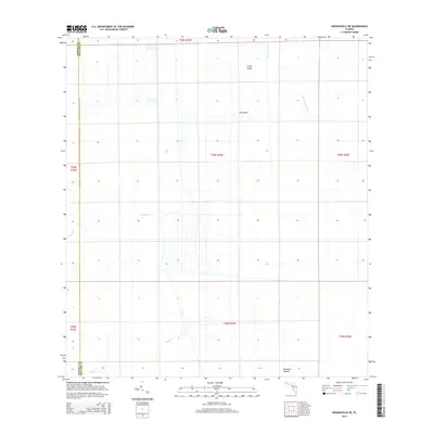
2015 Map of Kenansville NE
USGS Topo · Published 2015About this map
Saint Johns River defines the watery landscape of this interior Florida region, where the marshy lowlands are broken by subtle rises such as Camp Island and Jug Island. The terrain is characterized by a network of drainage canals and natural waterways, including Tenmile Cr and Wolf Cr, which reveal the ongoing efforts to manage the wetlands of the Upper St. Johns River Basin. To the south, Mulberry Mound stands as a notable landmark on the edge of the wetlands. The map clearly delineates the administrative boundary between Osceola and Brevard Counties, showing how modern land divisions intersect with the ancient hydrologic patterns of the river valley. This survey captures the transition from undisturbed marsh to structured land management, providing a clear record of the rural landscape before further development.
Find a feature on this map
14 named features on this map. Tap any name to fly to it.
Don’t see what you’re looking for? This feature index may not catch every label — zoom into the map to look around manually.
Map Details
Editions of this 2015 Kenansville NE Map
This is the sole edition of this map. No revisions or reprints were ever made.
Other maps of this area

1949 · Melbourne West
USGS Topo · 1:24,000

1951 · Melbourne West
USGS Topo · 1:24,000

1953 · Fellsmere SW
USGS Topo · 1:24,000

1953 · Fellsmere NW
USGS Topo · 1:24,000

1953 · Kenansville SW
USGS Topo · 1:24,000

1953 · Deer Park SE
USGS Topo · 1:24,000

1953 · Kenansville
USGS Topo · 1:24,000

1953 · Kenansville NE
USGS Topo · 1:24,000

1953 · Kenansville SE
USGS Topo · 1:24,000

1953 · Deer Park
USGS Topo · 1:24,000