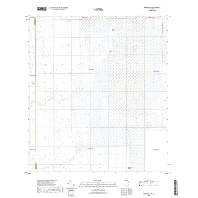
2018 Map of Kenansville NE
USGS Topo · Published 2018About this map
Saint Johns Marsh dominates this landscape on the border of Osceola and Brevard counties, where the Saint Johns River flows through a complex network of wetlands and seasonal drainages. The area is characterized by scattered hammocks or elevated terrain such as Camp Island, Jug Island, and the notably named Mulberry Mound in the southern portion of the quadrangle. These features stand out against the vast expanse of the Saint Johns Water Management Dist, which preserves the critical headwaters of the river. Infrastructure is sparse, concentrated primarily along the western edge with Kemper Rd and Ten Mile Rd. Further south, the natural hydrology is traced by Tenmile Cr and Wolf Cr, illustrating the primitive drainage patterns of central Florida's interior before significant modern development.
Find a feature on this map
21 named features on this map. Tap any name to fly to it.
Don’t see what you’re looking for? This feature index may not catch every label — zoom into the map to look around manually.
Map Details
Editions of this 2018 Kenansville NE Map
This is the sole edition of this map. No revisions or reprints were ever made.
Other maps of this area

1949 · Melbourne West
USGS Topo · 1:24,000

1951 · Melbourne West
USGS Topo · 1:24,000

1953 · Fellsmere SW
USGS Topo · 1:24,000

1953 · Fellsmere NW
USGS Topo · 1:24,000

1953 · Kenansville SW
USGS Topo · 1:24,000

1953 · Deer Park SE
USGS Topo · 1:24,000

1953 · Kenansville
USGS Topo · 1:24,000

1953 · Kenansville NE
USGS Topo · 1:24,000

1953 · Kenansville SE
USGS Topo · 1:24,000

1953 · Deer Park
USGS Topo · 1:24,000