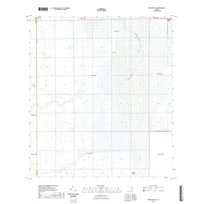
2021 Map of Kenansville NE
USGS Topo · Published 2021About this map
The Saint Johns Marsh dominates this landscape on the western edge of Palm Bay, where the headwaters of the Saint Johns River weave through a complex system of wetlands and hammocks. Elevated terrain features like Camp Island, Jug Island, and Mulberry Mound serve as prominent landmarks within the drainage basin of Tenmile Cr and Wolf Cr. This modern survey reflects contemporary water management and conservation priorities, specifically highlighting the Saint Johns Water Management District and the Three Forks Marsh Conservation Area Trl. While the grid of section lines and roads like Kempfer Rd and Ten Mile Rd mark the encroaching rural development, much of the area remains dedicated to the natural hydrological flow of the Florida interior. Researchers can trace the modern paths of the St Johns River Blueway Trl alongside traditional drainage patterns that have long defined this portion of the Brevard and Osceola County border.
Find a feature on this map
25 named features on this map. Tap any name to fly to it.
Don’t see what you’re looking for? This feature index may not catch every label — zoom into the map to look around manually.
Map Details
Editions of this 2021 Kenansville NE Map
This is the sole edition of this map. No revisions or reprints were ever made.
Other maps of this area

1949 · Melbourne West
USGS Topo · 1:24,000

1951 · Melbourne West
USGS Topo · 1:24,000

1953 · Fellsmere SW
USGS Topo · 1:24,000

1953 · Fellsmere NW
USGS Topo · 1:24,000

1953 · Kenansville SW
USGS Topo · 1:24,000

1953 · Deer Park SE
USGS Topo · 1:24,000

1953 · Kenansville
USGS Topo · 1:24,000

1953 · Kenansville NE
USGS Topo · 1:24,000

1953 · Kenansville SE
USGS Topo · 1:24,000

1953 · Deer Park
USGS Topo · 1:24,000