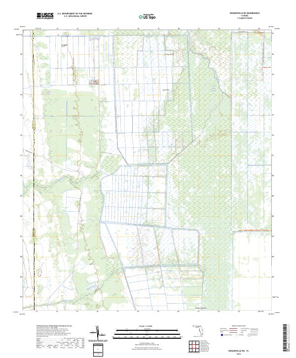
2024 Map of Kenansville NE
USGS Topo · Published 2024About this map
The Saint Johns Marsh dominates this landscape along the border of Osceola and Brevard counties, where the headwaters of the Saint Johns River weave through a complex of wetlands and hammocks. The map details a transition from managed agricultural grids in the west to the preserved natural hydrology of the east, highlighted by the Three Forks Marsh Conservation Area Trl. Notable elevated features like Camp Island, Jug Island, and Mulberry Mound appear as distinct rises within the surrounding marshland, suggesting the historical significance of these locations for navigation and habitation in a seasonally flooded environment. Waterways such as Tenmile Creek and Wolf Creek define the drainage patterns of this reach, while the St Johns River Blueway Trl marks a modern corridor for exploring this riverine system.
Find a feature on this map
24 named features on this map. Tap any name to fly to it.
Don’t see what you’re looking for? This feature index may not catch every label — zoom into the map to look around manually.
Map Details
Editions of this 2024 Kenansville NE Map
This is the sole edition of this map. No revisions or reprints were ever made.
Other maps of this area

1949 · Melbourne West
USGS Topo · 1:24,000

1951 · Melbourne West
USGS Topo · 1:24,000

1953 · Fellsmere SW
USGS Topo · 1:24,000

1953 · Fellsmere NW
USGS Topo · 1:24,000

1953 · Kenansville SW
USGS Topo · 1:24,000

1953 · Deer Park SE
USGS Topo · 1:24,000

1953 · Kenansville
USGS Topo · 1:24,000

1953 · Kenansville NE
USGS Topo · 1:24,000

1953 · Kenansville SE
USGS Topo · 1:24,000

1953 · Deer Park
USGS Topo · 1:24,000