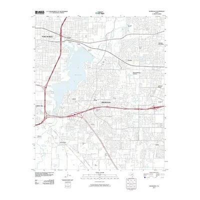
2010 Map of Kennedale
USGS Topo · Published 2010About this map
Lake Arlington serves as the dominant hydrological center for this portion of the Metroplex, bounded by the growing suburban corridors of Arlington and Fort Worth. The landscape reveals a densely gridded residential and commercial expansion that surrounds earlier landmarks like Arlington Dam and Rush Creek Lake Dam. For those tracing local heritage, several historic burial grounds are preserved amid the development, including Handley Cemetery, Tate Cemetery, and Hawkins Cemetery. Smaller communities such as Pantego, Dalworthington Gardens, and Kennedale retain their distinct identities despite the encroachment of major transit arteries. Recreational and industrial history is represented by the Forest Hill Drag Strip and local aviation sites like Action Aero Airport, showing how the land shifted from rural crossroads like Johnsons Station to a multifaceted urbanized region.
Find a feature on this map
52 named features on this map. Tap any name to fly to it.
Don’t see what you’re looking for? This feature index may not catch every label — zoom into the map to look around manually.
Map Details
Editions of this 2010 Kennedale Map
This is the sole edition of this map. No revisions or reprints were ever made.
Other maps of this area

1894 · Fort Worth
USGS Topo · 1:125,000

1931 · Grapevine
USGS Topo · 1:62,500

1954 · Dallas
USGS Topo · 1:250,000

1955 · Haltom City
USGS Topo · 1:24,000

1955 · Burleson
USGS Topo · 1:24,000

1955 · Fort Worth
USGS Topo · 1:24,000

1955 · Haltom City
USGS Topo · 1:62,500

1958 · Dallas
USGS Topo · 1:250,000

1959 · Kennedale
USGS Topo · 1:24,000

1959 · Arlington
USGS Topo · 1:24,000